

Design: Kat Lamp. Click to enlarge.
Sense of place is key to a lot of brands. Especially when the brand IS a place, like Greensboro, North Carolina.
Greensboro is a middling sized city grappling with challenges like most middling American urban centers. Marketing cities is a process of identifying strategic advantages and unique points of difference that give the location a personality…a sense of place.

© Kat Lamp. All rights reserved.
When Greensboro needed our help to appeal to young professionals, they presented a list of attributes that appeal to Millennials who have or seek good jobs and plan to start families.
We love projects where we can collaborate with native talent and this one was an opportunity to put out a Bat Signal to Kat. Kat Lamp, that is. She’s an amazingly talented illustrator with a whimsical style whose work is notably seen in musical promotions, including those of the similarly native musicians, The Avett Brothers.
Greensboro needed a fun map that was more about personality than navigation. And it was going to be the center spread of a tiny little brochure that folded out to 17″ by 11″.

© Kat Lamp. All rights reserved.
The result is a marvelously not-to-scale pictographic depiction of the Gate City to promote key landmarks and destinations, but most importantly to brand Greensboro as a town that doesn’t take itself too seriously, in the usual manner of chamber of commerce grandiosity.
Okay, so maps can be fun and pretty. But what if you need actually get somewhere?
Maps can still be fun and pretty.
Downtown Greensboro is 99 blocks and like a lot of middling downtowns, it’s growing in the wave of new urbanism. So there’s beer and public art and food and beer and baseball and museums and beer.
Art director Andy Kurtts and designer Tomas Lopez got inspired by the promotional art for the 1968 Olympic Games in Mexico City, credited to artist Lance Wyman, to develop a functional, but fab, map to find your way around Downtown Greensboro.
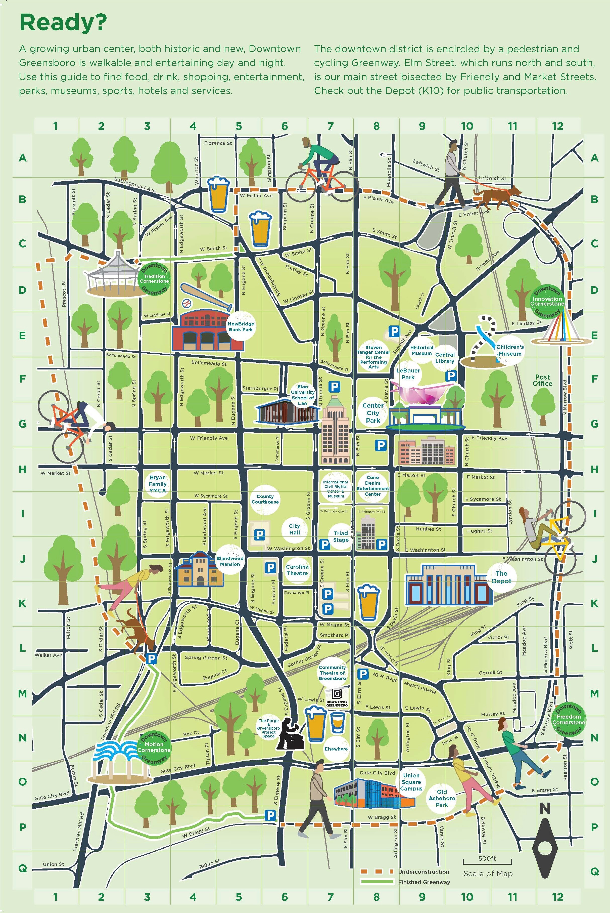
Click to enlarge. Design: Andy Kurtts, Tomas Lopez.
The pictographs are there but it’s all integrated with a map that is not only to scale but superimposed by a dual-axis location grid that makes it easy to find specific destinations…and beer.
You can integrate fun maps with digital maps
For websites you can even integrate digital features for navigation. Check it out here.

